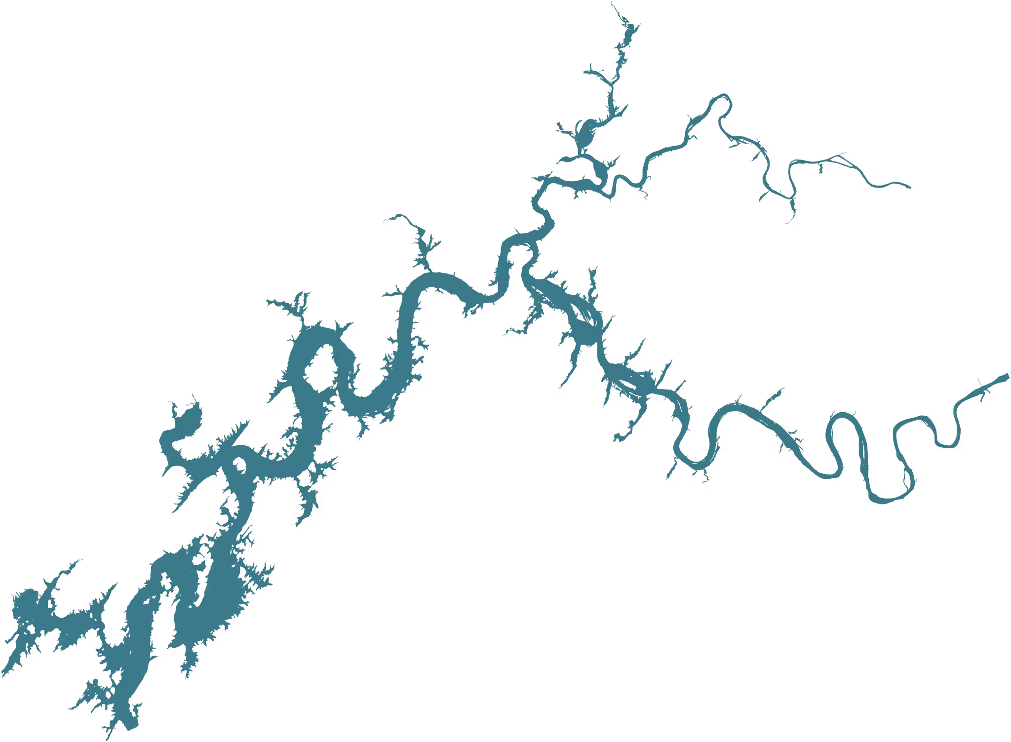
Free Watts Bar Lake Vector. SVG, PDF, EPS, DXF, GeoJSON, Shapefile, High-Res PNG.
Every Watts Bar Lake vector file you’ll ever need. Every reasonable format, every reasonable color combination, no signup, no watermark, no paywall. Just the files.

The honest pitch
If you’ve searched for a Watts Bar Lake vector before, you’ve probably noticed Etsy is full of people selling these. Five bucks here, fifteen bucks there. Nobody on Etsy went out and personally surveyed this lake. They didn’t hike the shoreline with a GPS. They didn’t commission a cartographer. They downloaded the same OpenStreetMap polygon anyone can pull, opened it in Illustrator, ran a couple of filters, and listed it for $12. It is not original work. It is the same public-domain map data, repackaged behind a paywall that exploits people who don’t know the data is free.
The data has been free to download since the 1990s. It’s been hiding on a complicated US Geological Survey website in formats your Cricut doesn’t understand. The Etsy sellers know that. They’re betting you don’t. We’re tipping the scale: here are all the same files, every format anyone might want, every color combination, no markup, no signup, no watermark, no $12 receipt in your inbox. Public domain because we say so, and because the source data was already public domain to begin with.
If this saves you a few bucks, the only thing we’d ask back is that you tell somebody. Share this page. Link to watts.bar from somewhere on the internet. The more this page gets indexed, the harder it gets for the next opportunist to charge for the same thing.
Quick downloads
Most people want one of these four. If your use case isn’t obvious from the names below, skip to "Pick by use case" or scroll further for every variant.
SVG
Vector for the web, modern design tools, Cricut.
Universal vector. Opens in Illustrator, Affinity, Inkscape, every print shop.
Pick by use case
Web designers & developers
SVG is what you want. The simplified version is ~10× smaller than the full file and renders identical at typical screen sizes. WebP, AVIF, and PNG are raster fallbacks if you need them; TopoJSON is for D3 / observable charts.
Print, illustration, and Adobe / Affinity / Inkscape
PDF is the universal vector format and opens cleanly in Illustrator, Affinity Designer, Inkscape, and every print shop. EPS is the legacy print format if a vendor specifically asks for it. The 8192 px PNG is more than enough for poster-size printing at 300 DPI.
Laser cutters, CNC, vinyl, Cricut, Silhouette
DXF is the standard for hardware: laser cutters, CNC routers, AutoCAD, Fusion 360. For Cricut and Silhouette vinyl cutters, use the silhouette SVG (solid black on transparent), which is the format their software expects. If the cutter’s software chokes on the full geometry, try the simplified SVG instead.
GIS & mapping
The full GIS bundle. Shapefile is the GIS lingua franca; GeoPackage is its modern replacement. KML/KMZ open in Google Earth. GeoJSON is the easiest format to script against. The geometry is the same in all of them.
Color and style variants
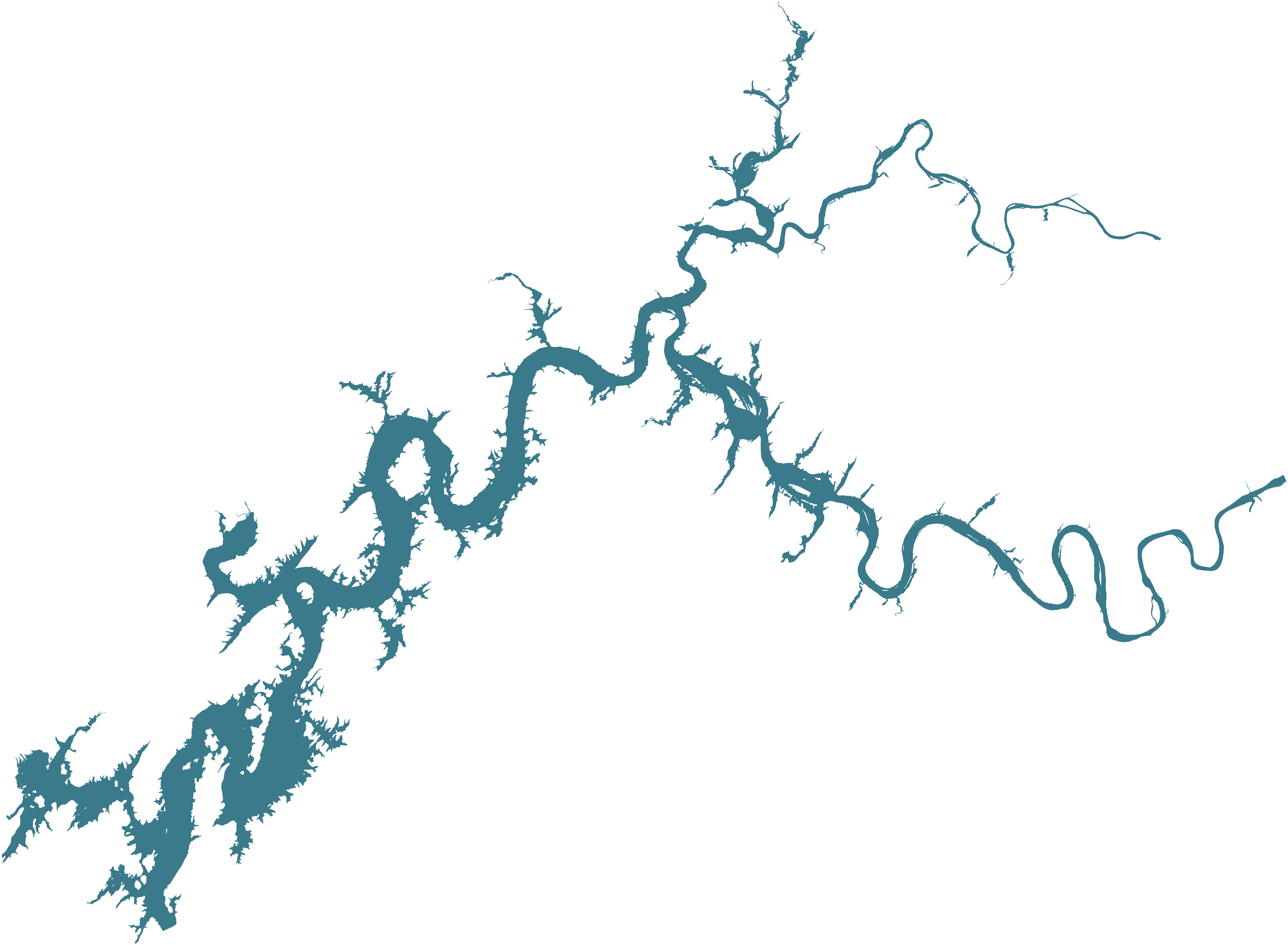
Every reasonable combination. Each row links to a vector (SVG plus PDF or EPS where it makes sense) and four PNG resolutions: 1024, 2048, 4096, and 8192 pixels wide. The default filled teal uses watts.bar’s brand color. Silhouette is solid black on transparent. Outline is just the shoreline stroke. The background-filled variants (such as "black on white") have a solid colored rectangle behind the lake so you can drop them onto a layout without compositing.
A few facts about Watts Bar Lake
For anyone who landed here from a search and wants to put a sentence of context next to the outline they’re embedding: Watts Bar Lake is a 39,000-acre Tennessee Valley Authority reservoir on the Tennessee River. It’s formed by Watts Bar Dam at Tennessee River Mile 529.9 and stretches roughly 72 river miles upstream to Fort Loudoun Dam. The lake spans four East Tennessee counties (Roane, Meigs, Rhea, and Loudon) and touches the towns of Kingston, Rockwood, Spring City, Ten Mile, Decatur, and Loudon. Summer pool sits at 741 feet above sea level. Winter draw-down hovers near 735 feet.
The lake is part of the larger Tennessee Valley Authority reservoir system, alongside Fort Loudoun, Tellico, Chickamauga, and the rest of the chain. If you need vectors or maps for any of those, the same techniques used for this page apply (extract from OpenStreetMap, project through State Plane, render). We don’t host them yet, but we may eventually.
License
The renderings are released to the public domain under CC0 1.0. Paint it on a boat. Screen-print it on t-shirts and sell those t-shirts. Frame it on your wall. Embed it on your website. Laser-cut it into wooden coasters. Ship it as part of a software product. None of that requires asking us or paying us.
The lake-outline geometry comes from OpenStreetMap relation 1376486 (the underlying database is licensed under the ODbL), projected through the Tennessee State Plane (Lambert Conformal Conic) so the lake’s east-west aspect ratio renders correctly. OSM asks for one thing: wherever you end up using these files publicly, credit OpenStreetMap somewhere a person could find it.
If you sell Watts Bar shirts on Etsy, a line in your listing description like “Lake outline © OpenStreetMap contributors” covers it. If you laser-cut a sign for your dock, the credit can sit on the back. If you embed it on your own website, a small note in the footer works. Technically, the credit just needs to exist somewhere a person could find it. How you do that, or if you do that, is up to you.
Frequently asked
Is this Watts Bar Lake vector really free?
Yes. Free for any use, no signup, no watermark, no paywall. The renderings are CC0. The one ask attached: the lake outline geometry comes from OpenStreetMap, and OSM asks that you credit them somewhere wherever you end up using these files publicly. If you sell Watts Bar shirts on Etsy, a line in your listing description like “Lake outline © OpenStreetMap contributors” covers it. If you laser-cut a sign, the credit can sit on the back. Technically, the credit just needs to exist somewhere a person could find it. How you do that, or if you do that, is up to you.
Do I have to credit watts.bar?
No. The renderings are CC0; we don’t need credit. We’d still appreciate a link or share if you found this page useful, but it’s not required and we’re not tracking it.
Can I sell things made from this vector?
Yes. T-shirts, mugs, prints, coasters, custom maps, fine-art posters, anything. CC0 places no restrictions on commercial use. You’ll want to credit OpenStreetMap somewhere on the finished product (or in the listing) so the underlying data attribution is honored, but the form of that credit is up to you.
What file format do I need for a laser cutter or vinyl cutter?
DXF is the standard for laser cutters, CNC routers, and most CAD software. SVG works for Cricut and Silhouette vinyl cutters. The "silhouette" SVG (solid black on transparent) is what most cutters expect. If your software chokes on the full geometry, try the simplified SVG. It’s about 10× smaller and looks identical at typical cutting sizes.
What’s the difference between SVG, PDF, and EPS?
All three are vector formats. The geometry is identical in all of them. SVG is best for the web and modern design tools (Figma, Affinity, Inkscape, Illustrator). PDF is universal. Every print shop and every design app opens it. EPS is the legacy print and illustration format. Mostly useful if a vendor or older Illustrator workflow specifically asks for it. If you’re not sure, use PDF.
What’s the difference between the “simplified” SVG and the regular one?
The full SVG preserves every inch of shoreline detail and weighs ~253 KB. The simplified version reduces the geometry to about 8% of the points, weighs ~21 KB, and looks visually identical at any size you’d display on a screen. Use simplified for web. Use full for print.
Can I open these in Adobe Illustrator?
Yes. Open the .pdf or the .svg directly. Both come in clean as editable vector layers. Affinity Designer, Inkscape, Figma, and CorelDRAW all handle them too.
Can I open these in AutoCAD or Fusion 360?
Yes. Use the .dxf file. It’s the standard interchange format for CAD software, and it’s the format laser cutters and CNC routers want.
Why is the lake oriented this way?
The polygon is projected through Tennessee State Plane (Lambert Conformal Conic), which keeps the east-west aspect ratio of the lake correct for this latitude. If you used a raw lon/lat plot, the lake would look noticeably stretched horizontally because Watts Bar is at 35.6°N. State Plane is what most Tennessee GIS work uses.
Where exactly does the outline come from?
The polygon was extracted from OpenStreetMap relation 1376486 ("Watts Bar Lake", natural=water) using the Overpass API, converted to GeoJSON with osmtogeojson, projected with mapshaper, and styled and rasterized with rsvg-convert. OSM’s lake polygon is itself digitized from US Geological Survey hydrography. If you want the rawest possible source, the USGS National Hydrography Dataset has its own slightly different version of the same lake. It’s public domain.
What if I need a feature that isn’t here?
If we missed a color, format, or size you need, drop a note and we’ll add it. We don’t want anyone going back to Etsy because we forgot to ship a 4096-pixel transparent PNG.
Can I use this for a logo, band merch, or business?
Yes. CC0 means no restrictions of any kind. Trademark is a separate question (we don’t hold one on the lake outline; we don’t think anyone does), but for normal commercial use of the artwork itself, you’re free to do whatever.
Is there a Fort Loudoun Lake or Chickamauga Lake vector too?
Yes, plus the rest of the Tennessee River system. We’ve published the same set of files for every TVA reservoir in the chain: Fort Loudoun, Tellico, Chickamauga, Nickajack, Guntersville, Wheeler, Wilson, Pickwick, Kentucky, plus Norris, Melton Hill, Cherokee, Douglas, Boone, South Holston, Watauga, Wilbur, Fort Patrick Henry, Hiwassee, Apalachia, Chatuge, Nottely, Fontana, Tims Ford, and the two Ocoee lakes. The full directory is at /free-lake-vectors/, with a mega-bundle of every file for every lake (~912 MB) at data.watts.bar/lake-vector/tn-river-lake-vectors.zip.
How do I open a Shapefile?
QGIS opens it directly. So does ArcGIS, ArcMap, Mapbox Studio, GeoServer, and just about every other GIS tool. Unzip the .shp.zip first; the .shp, .shx, .dbf, and .prj files all need to live next to each other. If you’re scripting, GeoPandas in Python reads them in one line.
How do I open a KML or KMZ?
Drop it onto Google Earth, Google Maps (My Maps), Garmin BaseCamp, or any modern GIS tool. KMZ is just a zipped KML; both work the same way.